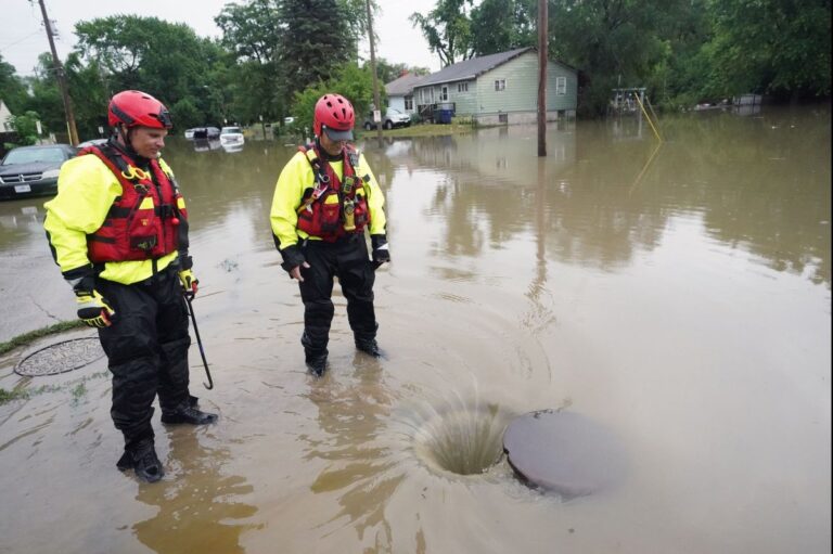
Parts of the northeastern United States, from eastern Pennsylvania to Maine, could receive a month's worth of rain within hours of Sunday, forecasters say. File photo by Bill Greenblatt/UPI
Residents across the northeastern United States were advised Saturday to be aware of the risk of flash flooding in the coming days as tropical moisture descends on the region.
Advertising
The incoming band of moisture could lead to devastating effects from eastern Pennsylvania to Maine — in some locations potentially dumping a month's worth of rain in a matter of hours, according to AccuWeather forecasters.
A slow-moving weather system is expected to draw moisture from the Gulf of Mexico and Atlantic Ocean as it slowly turns northeast Sunday into Tuesday. This track will direct a band of heavy rain across part of the mid-Atlantic and New England.
Heavy rain could cause injury in parts of New England where Friday's downpours led to shutdowns US Route 4 in Killington, Vt.after a mudslide threw debris onto the roadway, making it impassable.
Flash flooding was also reported in the Washington, DC and Baltimore metro areas, eastern Pennsylvania and eastern New York state to close out the week.
The high amounts of moisture available in the atmosphere will make this upcoming weather system a very effective producer of torrential rain, AccuWeather forecasters say.
“Rainfall rates could reach 2 inches per hour in some locations as the system moves slowly,” said AccuWeather Senior Meteorologist Adam Doughty. “Infrastructure in metro areas may not be able to handle rainfall of this magnitude and therefore, rising water could quickly flood some locations.”
The time of the heaviest rain on Sunday is likely to be in the afternoon and evening Washington. In Philadelphia, the heaviest precipitation is possible late Sunday afternoon through early Sunday evening. About New Yorkthe greatest risk of flooding will occur Sunday afternoon through early Monday morning.
“Rain from Sunday night could lead to significant travel delays for the Monday morning drive, especially if there are road closures due to high water,” said AccuWeather meteorologist Alex DaSilva.
In Bostonprecipitation is expected to be heaviest late monday, perhaps for home, through early tuesday morning.
“Widespread rainfall of 2-4 inches is forecast in the Northeast with an AccuWeather Local StormMax of 10 inches,” DaSilva said.
Historical average precipitation for the entire month of July is generally between 3 and 4.5 inches for major cities in the Northeast. During this event, some sites could collect the entire amount or even double it and it can drop within a few hours.
Motorists are likely to experience significant delays as a result of poor visibility and possible road closures. The amount of rain forecast will not only increase the risk of road flooding, but also lead to rapid upwelling along small streams, which can then overflow their banks.
Moisture-laden air will move into the mountains of upstate New York and New England, increasing precipitation over higher ground. Air hitting mountain ranges is forced upward, and this upward motion results in enhanced clouds and precipitation.
“We are closely monitoring the risk of landslides in the Green Mountains of Vermont. The heaviest rain is forecast to fall in the Green Mountains and this, combined with the rain that fell on Friday, may increase the potential for dangerous landslides in the mountains,” DaSilva said.
There will be another weather hazard for residents and visitors to be aware of as the weekend draws to a close and the second week of July begins.
“Mid-Atlantic storms Sunday afternoon will be capable of producing hail, damaging wind gusts and isolated tornadoes, in addition to flooding,” DaSilva said.
Locations where the ground is saturated from rainfall by the end of the week will face a higher chance of gusty winds knocking down trees and power lines in any of the stronger storms.
AccuWeather forecasters say rainfall will gradually decrease from west to east on Monday and Tuesday as the weather system responsible for the deluge moves further north and east.
A slight drop in moisture levels across the interior Northeast early next week will provide a brief respite from the stifling conditions of late. However, the warm weather with high humidity will quickly recover as the week progresses.


