Smoke forecast near the surface
Fires were detected
via satellite

Smoke forecast near the surface
Fires were detected
via satellite

Smoke forecast near the surface
Fires were detected
via satellite
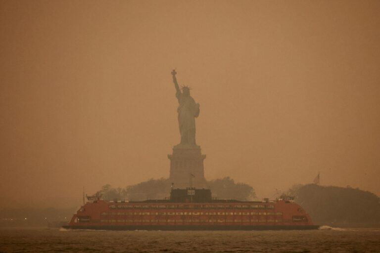
As of Tuesday afternoon, New York City had the worst air quality in the world among major cities. Scenes from social media and web cameras showed the sky above Manhattan to have a reddish-orange hue, drawing comparisons to Mars.
“If you're a New Yorker with heart or breathing problems, be careful when you're outdoors.” said New York City in a tweet signed by the mayor. “Smoke from wildfires in Canada is affecting our city air, so an Air Quality Advisory has been issued. Try to limit outdoor activities today to the bare essentials.”
By Wednesday morning, hazardous air quality reached Washington, D.C., where the air smelled of smoke and reduced visibility to two miles.
In some places, air quality readings are the worst on record. Marshall Burke, professor of environment at Stanford University, he tweeted that this event is the “[n]ear worse or worse event' over the past two decades or so, based on smoke particulate data.
New Haven, Conn., posted the worst air quality on record Tuesday while EPA measurements showed dangerous smoke pollution enveloping much of New York state and southern New England.
Where are the fires causing the smoke?
The source of much of the smoke falling in the region is Quebec, Canada. Most broke out last week. Across Canada, there are 416 active fires, 240 of which the Canadian Interagency Center for Wildfires reports as “out of control.”
The fires occurred under a well-predicted “heat dome” or high pressure zone, which brought sinking air and warm, dry conditions which broke records for the time and location.
Low pressure swirling counterclockwise over Nova Scotia, meanwhile, creates a conveyor belt of northerly winds that funnels the smoke south over the Great Lakes, Northeast, and Mid-Atlantic.
Where is the smoke and where is it worst?
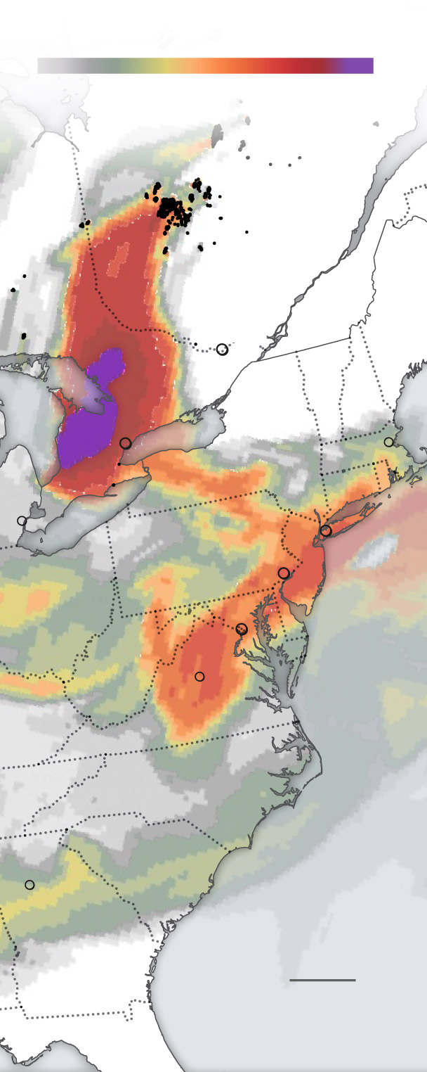
Satellite images Wednesday morning showed smoke blanketing the northeast and extending into the Carolinas. The densest ones extended from Lakes Erie and Ontario to southern New York state.
That said, hazardous air quality reached western Minnesota on Tuesday, according to AirNow.gov, and the Carolinas by Wednesday morning.
The environmental agency issued air quality warnings for a wide swath of the Northeast and Mid-Atlantic effective Wednesday, warning that “sensitive people, including those with heart or lung disease, the elderly and the young should limit their exposure to strenuous activities and the amount of time spent outdoors.”
The warnings cover southeastern Michigan, parts of Ohio, northern South Carolina, much of North Carolina, northern Virginia, Maryland, Delaware, eastern Pennsylvania, New York, Vermont, Massachusetts, Connecticut, of Rhode Island and western New Hampshire.
During Tuesday, some of the worst air quality was concentrated in western New York in Quebec and Ontario, where red and purple conditions prevailed, meaning air quality was hazardous for all populations.
Jase Bernhardt, professor of meteorology at Hofstra University, is determined that the air quality index in Syracuse, New York, was the worst since reliable records began in 1999.
Particulate pollution in Detroit and New York was recorded at highest and second highest levels, respectively, since 2006, Stanford's Burke found.
Meanwhile, meteorologists at the Weather Service in Burlington, Vt., called the smoke situation “uncharted territory,” never having experienced it before. “[W]they learn and adapt as the event unfolds.” they wrote in a discussion.
With no end in sight to the fires, the question is how long the smoke stays downwind.
From Wednesday into Thursday, an even worse round of smoke from the wildfire could erupt south of Canada on the back of a cold front moving from north to south. Pennsylvania, New York state and the Mid-Atlantic – including large metro areas such as Philadelphia, Newark, New York, Baltimore, Washington and Richmond – are likely to see very poor air quality. Outdoor recreation would probably be dangerous.
Winds will be northwesterly Friday through Saturday. Although this will not completely clear the smoke, it will reduce concentrations of fine particles. Visibility, sky conditions and air quality will improve somewhat.
How unusual are fires?
Very unusual. Wildfires are normal to some extent across Canada and the western United States in the summer, but outbreaks as extensive and numerous as these are almost unheard of in late May through June. The amount of smoke falling in the northeast is therefore also exceptional.
Canadian Broadcast Corp. posted a sobering chart comparing the area burned so far this year to previous years:
Some perspective on Canada's wildfires…this shows a total of millions of hectares burned in Canada.
With over 3.5 million hectares burned so far, not only is this year beyond all but one of the last 6 totals, but it will do so before the real fire season begins in July#nywx pic.twitter.com/XpFLlqt55d
— Jim Teske (@JimTeskeNC9) June 6, 2023
While fires can be started in many different ways, the speed at which they spread is proportional to how hot and dry the surrounding environment is. There is a strong relationship between the frequency and intensity of heat domes and human-induced climate change. Some high-profile heat domes have already fueled wildfire outbreaks across Canada this year, and it looks like more are on the way.
Jason Samenow contributed to this report.


